Mount Cook
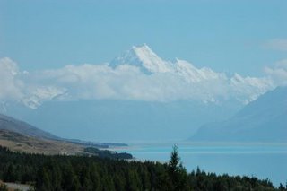
Wednesday 28 December; Mount Cook. SH80 was one of the images of NZ that I had in my head before I came here. The pictures I'd seen showed a road of fast flowing bends skirting the edge of pine forests on the edge of an azure blue lake leading to snow clad mountains of the Southern Alps and Mt Cook in the distance. When I was having my teeth scraped I'd imagine riding that road, and the mental imagery took me there and away from the pain of the dentist's chair! The reality is as spectacular, but the road doesn't bend as much as in my imagination so no rush to take the bike there. The view, however, did not disappoint.
Mt Cook Village itself consists of a Department of Conservation information centre, an alpine style hotel and an overpriced cafe....$18 for a sandwich, I don't care how you dress it up with salad and bits I'm not paying that x4, so we consumed our flask of coffee and our biscuit supply instead.
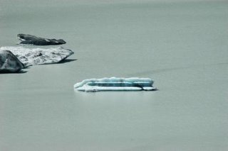
As we were not really prepared for any long tramps we chose the route to Tasman Glacier instead. A long gravel track leads up to parking, toilets and a shelter. A 20 minute climb to the vantage point reveals views of the Tasman Glacier, an impressive valley glacier that flows for several miles below the east side of Mt. Cook. The glacier is one of the longest in the world outside the polar regions and is home to the world's longest ski run. The ice also lies below the shingle (surface moraine) and the terminus lake. The surface moraine is about 1 m thick, the ice is about 200 m thick below this.
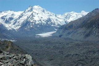
Terminus lake forming at the base. This process formed Lake Tekapo, Lake Pukaki and Lake Ohau as the Tasman retreated.

Mt Cook Village itself consists of a Department of Conservation information centre, an alpine style hotel and an overpriced cafe....$18 for a sandwich, I don't care how you dress it up with salad and bits I'm not paying that x4, so we consumed our flask of coffee and our biscuit supply instead.
As we were not really prepared for any long tramps we chose the route to Tasman Glacier instead. A long gravel track leads up to parking, toilets and a shelter. A 20 minute climb to the vantage point reveals views of the Tasman Glacier, an impressive valley glacier that flows for several miles below the east side of Mt. Cook. The glacier is one of the longest in the world outside the polar regions and is home to the world's longest ski run. The ice also lies below the shingle (surface moraine) and the terminus lake. The surface moraine is about 1 m thick, the ice is about 200 m thick below this.

Terminus lake forming at the base. This process formed Lake Tekapo, Lake Pukaki and Lake Ohau as the Tasman retreated.
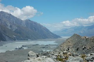
Having done the walk a 4WD track leading from the DoC site up to the glacier seemed like a good idea. 9 km up a track made primarily of rocky scree it was a bumpy hours journey to the end of the track. Another tramp could have taken us to the ice, but we contented ourselves with the view.
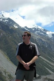
'The hills are alive, with the sound of music'


0 Comments:
Post a Comment
<< Home