Glenorchy Rally 2006 - Day 2
 The morning was damp and miserable. My compadres were all heading back up the way I'd been the day before. They thought the West Coast would be a wet ride. Not knowing if I'd get the chance to ride it again I decided to go for it.
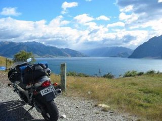
The ride back to Queenstown was through the pouring rain. I stopped for fuel and had to defrost my hands under the drier before I could drink my coffee, it was like a winters ride. Was I letting myself in for worse on the west coast? This view is towards Queenstown from the start of the Crown Range road towards Wanaka.
You've seen the shoe fence, now the bra fence outside Cardrona. The Crown Range road was superb, there were flourescent road markers along the sides of the road for when it snows.
Lake Wanaka.
SH6 to the west coast first skirts the western shore of Lake Hawea (shown), bears around Isthmus Peak ad then skirts the north eastern shore of Lake Wanaka.
Exiting Lake Wanaka SH6 then enters the Mount Aspiring National Park and continues through densely clad, between almost vertical mountainous passes. It was drizzly and the road surface was wet, but boy was it grippy!
SH6 emerges at Haast. This is a view up the Haast River, Mosquito Hill to the left and Mt Browne on the right.
Despite the opinions on the weather I couldn't have got better. It had been raining heavily but the sun had burnt most of it off, in places steam billowed up from the road surface as I tore along it. The scale of the greenery all along the west coast needs to be seen to be believed, I'd read about it but couldn't picture it from the words. Imagine fast sweeping bends, tight twisty mountain passes and fast valley straights surrounded by Kew Gardens ... for about 200 miles, with only 20 or so other vehicles. Biking nirvana!
View southwest from Knights Point Lookout.
View northeast from Knights Point Lookout, the road sweeping inland towards Lake Moeraki.
I think this was Bruce Bay.
One of many rivers crossings.
A quick diversion up to the Fox Glacier.
SH6 sweeps through National Park after NP, this is in the Westland National Park.
Pie and chips in Whataroa for lunch.
I think this is the Waitaha River.
 No pics crossing Arthurs Pass, this is the Waimakiri River.

Castle Hill.

The final descent down to the Canterbury Plain.
Back home, I'd covered 916.2 miles in 2 days. I was sore, I was tired but what a fantastic weekend, just what I needed. That's what the roads in New Zealand are like!
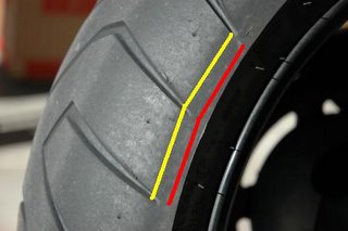
Or instead of the thousand words I could have posted just one picture, before and after!


0 Comments:
Post a Comment
<< Home